
Mentor ZIP Code Directory Coverage
Lake County’s Postal Districts map is the strongest local source for the main delivery area. It identifies 44060 as the standard-delivery code for Mentor and identifies the Mentor Post Office at 8600 Tyler Road. The same map shows why a postal label cannot be used as a municipal finding. Its 44060 district overlaps areas labeled Mentor-on-the-Lake, part of Concord, and part of Kirtland Hills as well as City of Mentor.
| ZIP | Areas Covered | Post Office | Notes |
|---|---|---|---|
| 44060 | Standard delivery for Mentor; the county map also depicts overlap with Mentor-on-the-Lake, part of Concord, and part of Kirtland Hills | Mentor Post Office, 8600 Tyler Road | Confirm the parcel and jurisdiction for an exact address. |
| 44061 | Mentor-associated in historic USPS material | Not confirmed by the county postal map | Current boundary and service type were not confirmed. Verify the exact address with USPS. |
| 44094 | Kirtland on the county postal map | Kirtland postal geography | Nearby Lake County geography, not a City of Mentor code on the county map. |
The table separates evidence from assumption. The historic USPS material groups 44060 and 44061 in a distribution listing, but it does not establish a current boundary or service class for 44061. Likewise, 44094 is included only to prevent a nearby Kirtland label from being attached to Mentor without an address-specific check.
Why 44060 Reaches Beyond Mentor
Postal delivery districts are routing tools. They are not City limits, wards, parcel lines, or statistical areas. An address using 44060 can be in City of Mentor, Mentor-on-the-Lake, part of Concord, or part of Kirtland Hills according to the county map depiction. The City name on a mail line is a delivery convention, not evidence that a City department created the record or that the parcel lies inside the City.
This distinction affects record routing. A City permit question needs the exact street address and jurisdiction. A county land record needs the parcel or legal-description lead. A delivery code by itself is not enough for either task.
Make the check in two passes when a postal label crosses a familiar community name. First, use the exact address with USPS for delivery. Next, use the Auditor parcel result and Lake Navigator’s jurisdiction context for the location itself. This avoids sending a City request to the wrong custodian or describing a Lake County parcel as City property solely because the mail line says Mentor. It also leaves room for a historic source to use the locality label that was correct in its own period.
Confirm a Mentor Mailing ZIP
For a current mailing question, use the USPS ZIP Code Lookup with the exact address. That official route tests the delivery information for the specific location rather than relying on a broad community label or a historic postal list. It is the proper way to verify a code before mail is sent or a postal filter is used in a county search.
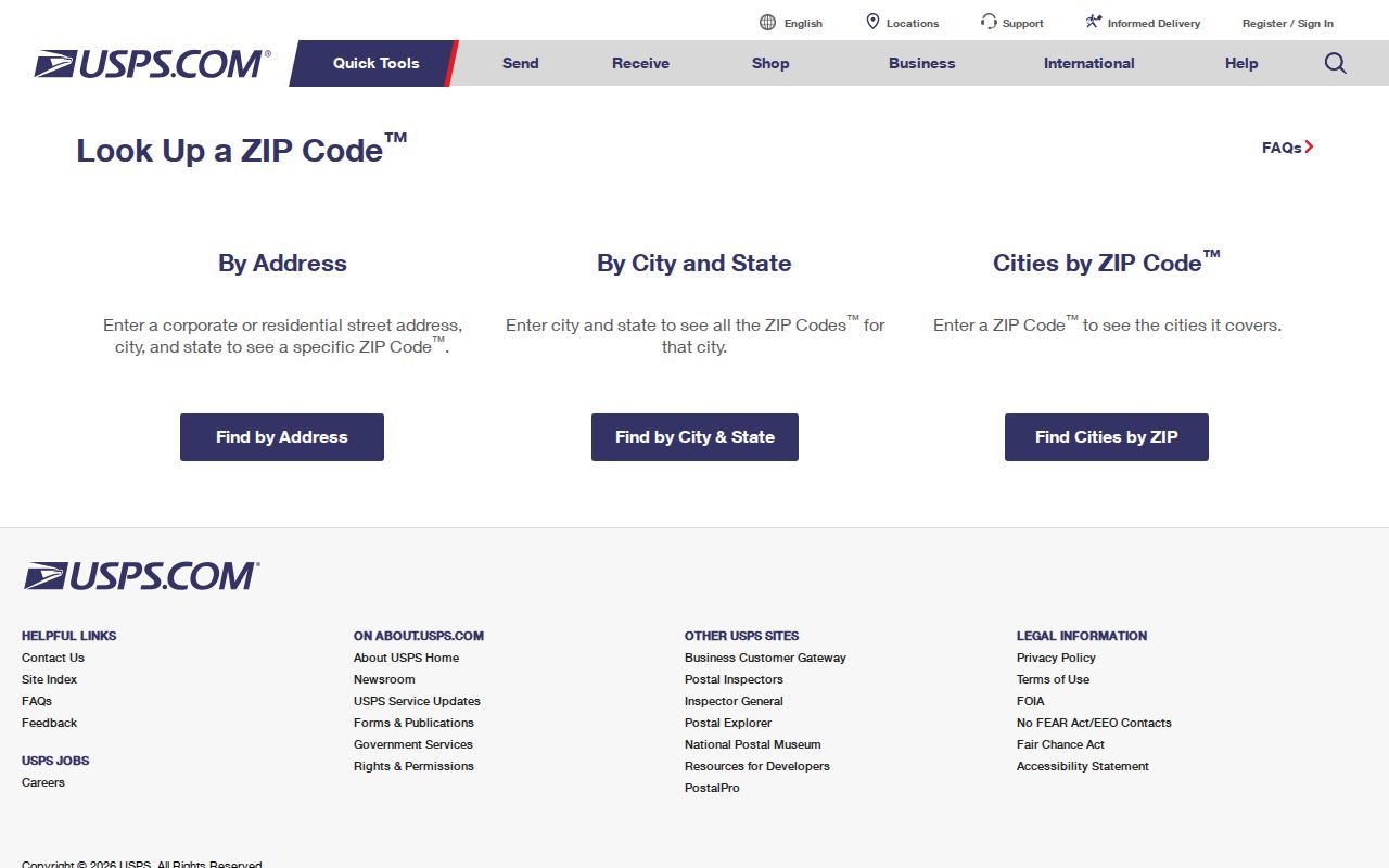
The USPS result should stay paired with the exact address used for the check. It answers a delivery question and does not determine City jurisdiction, parcel identity, or the historical locality term for older records.
The older USPS archive is useful only as historical context. It associates 44061 with Mentor in a past distribution listing, but it must not be used to declare that code current, exclusive to a particular service type, or bounded by a particular City line.
Mentor ZIP Code Filter Fields
The Lake County Auditor Basic Search includes Postal Code among its real-property controls. That makes it a practical filter for parcel research after the postal value is verified. It is still only a lead. The result may return a tax mailing field, assessment owner field, and parcel data, none of which establishes present physical presence at the property or the location’s City jurisdiction.
| Auditor field | Use in a postal-area search |
|---|---|
| Postal Code | Filters the Basic Search by postal code. Treat the result set as parcel leads, not a City boundary. |
| Address Number and Street | Narrow a postal result to an exact place before opening a parcel page. |
| Parcel ID | Connects a selected result to the county parcel record and legal description. |
| Owner | Offers an assessment-name field, with wildcard use only as the Auditor allows. |
| Directional or street controls | Help distinguish address terms where the form supplies separate controls. |
| Sort By and Results Per Page | Manage result order and the number of visible parcel results. |
| Search | Runs the chosen Basic Search terms. |
The Auditor Real Property Search also accepts parcel identifiers, owners, and addresses. If the search moves from a postal filter to a specific street, use the Mentor street directory for the full address-to-parcel-to-deed sequence.
Finding Records With a Mentor ZIP
A postal filter works best when it is treated as one stage of a narrower record workflow. The Auditor is the documented county tool that accepts Postal Code. Lake Navigator then places a selected address or parcel in its map and jurisdiction context. The Lake County voter lookup begins with first and last name, and its observed initial form does not show a postal-code field, so it should not be described as a postal search.
- Verify the full mailing address in the USPS lookup and retain the result date.
- Enter the verified postal value in the Auditor’s Postal Code field, then use street number and street fields to narrow a broad result.
- Open the selected parcel and note its parcel identifier, situs address, and legal description. Keep tax mailing data labeled as such.
- Enter the address or parcel identifier in Lake Navigator and inspect the jurisdiction/map context.
- Route any City request with the exact address, City or County context, record type, and date range. Do not send a postal value alone.
Lake Navigator accepts an address, parcel identifier, or owner/name through Universal Search and has Layer List, Legend, Measurement, Print, Buffer, Near Me, and Select tools. Its parcel display is not a survey. Use it to read geography around the address, not to draw a legal line from the screen.
Mentor Postal Geography and City Jurisdiction
Three questions often get folded into one. “What code should go on this mail piece?” is answered by USPS for an exact address. “Is the location inside City of Mentor?” is answered by the parcel and jurisdiction tools. “What locality term belongs in an old directory search?” is answered by the title, year, and period map or legal-description evidence. The same street may produce different, valid answers for each question.
The county map has no City-of-Mentor-only boundary polygon for every postal code associated with the word Mentor in the research reviewed. The GIS layer and Auditor parcel record are therefore the better sources for an address-specific City check. Lake Navigator’s parcel shapes remain map context, not a survey.
Note: Record the postal source date because delivery districts can change and a historic record may use a different place label.
Mentor Historic Postal Labels
Modern postal terms do not belong in older directory entries. Morley Library’s Mentor-inclusive collections and Lake County historic maps cover periods before the ZIP system existed. A historic entry should retain the locality name, directory title, edition year, and address style used in that source. Do not revise an older listing by adding a current delivery code or by assuming that a modern postal community matches an earlier municipal label.
Morley says street-address listings in its city-directory collection begin in 1923, and its titles vary among Mentor Village, Mentor, Mentor Headlands, and Painesville-Mentor. The county’s historic atlas resources include 1840, 1857, 1874, 1898, and 1915. These date bands can clarify an old road or place term, but they do not make a modern parcel or postal assignment certain.
A dated postal uncertainty is still useful research. It tells the reader to preserve the source wording and then test an address through the right period’s records instead of forcing a modern map onto the past.
Mentor ZIP Code Terms
Postal vocabulary can look more exact than it is. These terms describe mail routing, not land ownership or City limits. Keeping them separate from parcel language makes a Mentor address search easier to audit.
- ZIP
- A Postal Service routing code used with an address for delivery purposes.
- ZIP+4
- An added four-digit delivery detail used with the basic ZIP. It does not create a municipal boundary.
- PO box ZIP
- A postal code associated with box delivery. It should not be treated as a geographic point for a street address.
- Carrier route
- A delivery-route grouping used for mail handling. It is not a parcel boundary or a City jurisdiction layer.
Census ZIP Code Tabulation Areas are another related term. They are statistical approximations of delivery geography and should not be substituted for a City boundary or a USPS exact-address result.
Mentor ZIP Code Directory Limits
A postal result does not establish a property owner, a current physical presence, the edge of a City, or continuity between a historic and modern address. It also cannot resolve the unconfirmed current boundary or service type for 44061. Use the official USPS tool for the exact address, and describe 44061 only as Mentor-associated historic postal evidence unless a current check supports more.
When the research goal is an official record, identify the source that maintains it. The Auditor maintains taxable parcel information. Lake Navigator provides mapped context. The Recorder maintains recorded land instruments. City departments hold City-origin documents. Respect protections and redactions, and do not combine public fragments to expose a protected address.